New Hiking and Street Maps on Ventusky
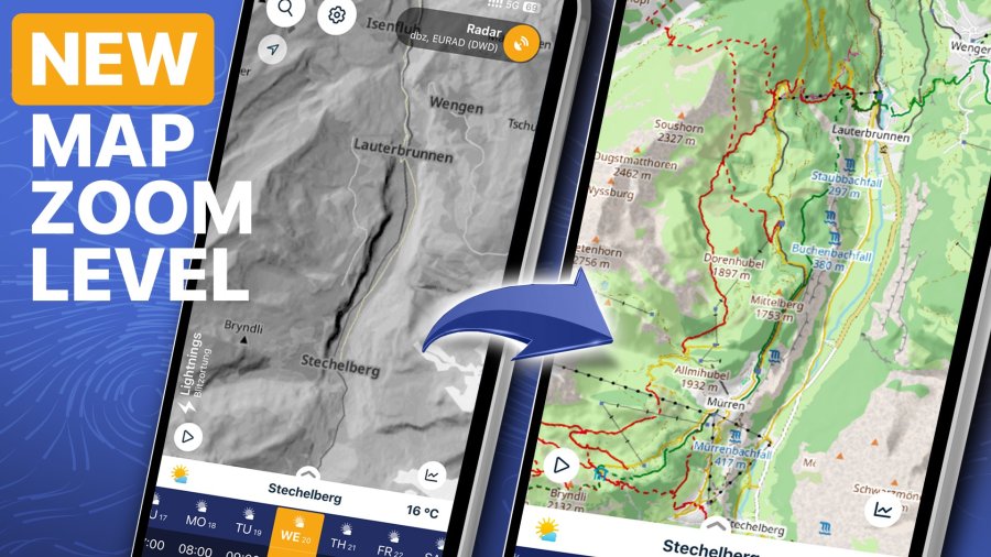
The Ventusky application for Android and iOS has just received its most detailed cartographic upgrade to date. Our new base-map, powered by OpenStreetMap (OSM), now drills all the way from sweeping alpine panoramas down to street level inside cities, giving outdoor enthusiasts—and urban commuters alike—a crystal-clear picture of the terrain ahead.

What’s on the map?
Hiking trails are colour-coded using standard mountain markings:
- Solid lines = easy, well-maintained paths
- Dashed lines = steeper or more technical routes
- Dotted lines = strenuous tracks that demand fitness and keen navigation
- Cycle paths stand out in vivid pink for instant routing.
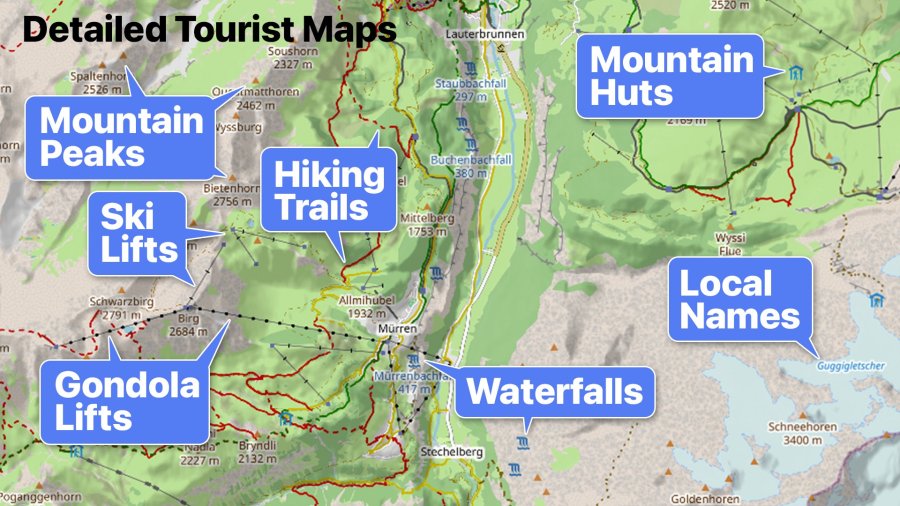
- An expanded set of points of interest now appears right on the canvas: ski lifts, gondolas and cable cars, natural attractions such as waterfalls, remote mountain huts, plentiful local names—and many mountain peaks with their elevations that were never displayed before.
Full street-level detail in towns and villages to help you plan neighbourhood walks, runs or commutes.

The puzzle of “too much heatmap”
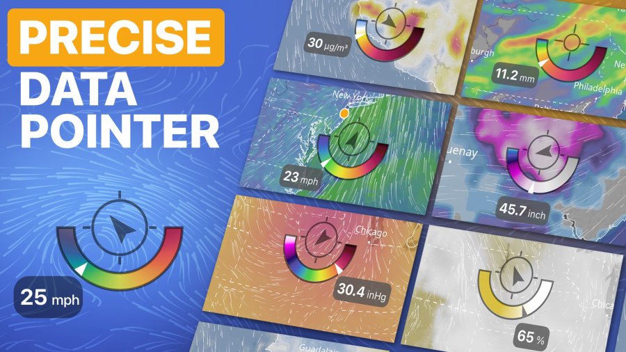
Covering such a beautiful, information-rich map with a solid weather overlay felt like a waste. Our answer is the brand-new Data Pointer—a compact gauge that sits neatly on the map and reports the precise value of whichever weather layer you’re viewing (temperature, rainfall, pressure, snow depth, air quality and more).
The pointer displays its own colour scale, so you understand what the number means without masking the underlying map. Whenever the wind animation is active, the pointer also draws an arrow showing wind direction—on every zoom level. By default, this tool appears only at the highest zoom to keep your overview clean, but power users can switch it on permanently in Settings.

Why the new detail matters
Out in the mountains you can now zoom directly to the very ridge, hut or waterfall you’re aiming for and pair that pinpoint location with exact forecast data. In the city, street-level resolution lets you see the weather situation for your own block or the next cycling turn. Whether you’re planning a summit push, a weekend ride or a quick dash to the grocery store, the new map and Data Pointer combine to deliver a step-change in precision.
Looking ahead
This release is only the beginning. Over the coming months we’ll be adding additional zoom levels to make navigation in complex terrain even smoother—especially in rugged alpine areas. With each update, Ventusky’s mission stays the same: give you the clearest possible window into the atmosphere so you can plan your outdoor activities with total confidence.
Update Ventusky today, zoom in, and explore your world—beautifully and precisely.