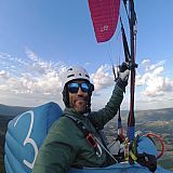
As a paraglider pilot, I'd like to suggest a few features that would make Ventusky significantly more useful for XC and free-flying pilots:
- Paragliding takeoff/landing spot database, a dedicated overlay layer showing known paragliding sites, ideally with orientation (wind direction suitability), altitude, and site notes. Pilots could select a spot and see the forecast tailored to that location.
- Aggregated live weather station and webcam data, many sites already have nearby live stations (wind speed/direction/gusts) and webcams. Ventusky could pull these into a selectable layer tied to each spot, similar to how model layers are currently toggled. This would massively improve userfirendliness.
- Last but not least, a day cross-section: a time-vs-altitude chart for a chosen point, showing terrain profile, thermal strength as a colored contour (ground to boundary layer top), wind barbs at each altitude/hour, condensation level and cloud cover overlaid, plus switchable views for lapse rate, temperature, relative humidity, and wind speed. This is what Skysight offers and Ventusky doesn't currently have. This is the single most useful tool for planning when and how high to fly.